Alfreton and Somercotes
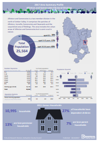
Alfreton and Somercotes is a two member division in the north of Amber Valley. It comprises the parishes of Alfreton, Ironville, Somercotes and Swanwick and the unparished area of Riddings. The area includes the urban areas of Alfreton and Somercotes but is semi-rural in nature. To view the Councillors’ information page please click on a councillors name Philip Rose, David Wilson
This page contains links to key information and statistics for this Electoral Division. The links to the maps and profiles are specific to this division, but some of the links such as to the Quilt are to generic information.
If you have any questions regarding any of the information on this page then please send an email to research@derbyshire.gov.uk
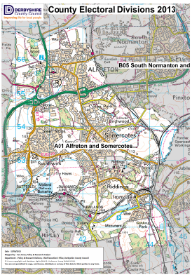
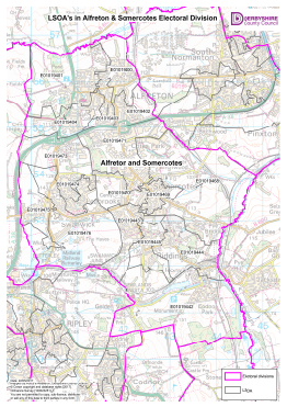
Electoral Division Maps
For detailed statistics and information on the following topics please click on the relevant link below
Population
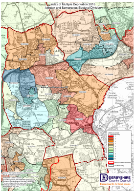
Deprivation
Unemployment
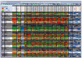
Area Profile, Quilt
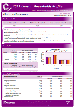
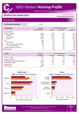
Census profiles